|
Garmin Electronics

Buy Now at our Online Store
We stock all Garmin Products and Accessories:
We also offer installation for all automotive and Marine Products.
If you do not see what you are looking for please call us at 1-866-868-7151 or Email at boatparts@boatsunlimitedny.com
|
- Automotive
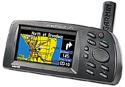
The simple, intuitive menus of the StreetPilot III offer access to the shortest and fastest routes, directions, and estimated arrival time of your intended destination. Automated voice prompts alert you to upcoming turns, course deviation, and distance to final destination. At the touch of a button, view the locations of all the nearest highway exits, gas stations, restaurants, ATMs, hospitals, and rest areas on a full-color L CD.
For more information and additional models
click here for the Garmin site.
|
Buy Now at our Online Store |
- Chartplotters/GPS
-
-
-
  -
For Blue Chart info click here.
For Fishing Hot Spot Info from Garmin click here.
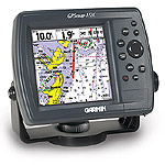
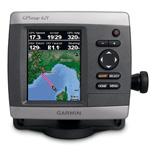
GPSMAP® 421 $399.00
The GPSMAP 421 is a compact chartplotter that features an ultra-bright 4 in (10.16 cm) QVGA color display along with an improved high-speed digital design for increased map drawing and panning speeds. It’s ready to go with a built-in, satellite-enhanced worldwide basemap and an easy-to-use interface designed to help you navigate the open waters with ease. The GPSMAP 421 also accepts BlueChart® g2 Vision® cards (sold separately) for added features and functionality such as high-resolution satellite imagery, 3-D views and Auto Guidance technology.
For more information and additional models
click here for the Garmin site.
|

|
- GPS Sounders
The GPSMAP 421 is a compact chartplotter that features an ultra-bright 4" (10.16 cm) QVGA color display along with an improved high-speed digital design for increased map drawing and panning speeds. It’s ready to go with a built-in, satellite-enhanced worldwide basemap and an easy-to-use interface designed to help you navigate the open waters with ease. The GPSMAP 421 also accepts BlueChart® g2 Vision® cards (sold separately) for added features and functionality such as high-resolution satellite imagery, 3-D views and Auto Guidance technology.
View Satellite-enhanced Worldwide Basemap
The GPSMAP 421 basemap contains worldwide satellite images in place of traditional maps. The GPSMAP 421 also comes standard with a high-sensitivity GPS receiver for superior satellite tracking and quicker acquisition times. In addition, the GPSMAP 421 can receive U.S. graphical weather data via optional GXM™ 51 satellite receiver/antenna. And with an SD™ card slot, it’s easy to add additional maps without connecting to a computer.
Add Extras with BlueChart g2 Vision
With the optional BlueChart g2 Vision SD card, you can add a whole new dimension of exceptional features to your chartplotter.
- MarinerEye view and FishEye view provide you a 3-D perspective of map information, both above and below the waterline.
- High-resolution satellite images and aerial photographs help you orient yourself in unfamiliar areas.
- Auto Guidance technology searches through all relevant charts to create a route you can actually follow — one that avoids obstacles, shallow water, buoys and other obstructions.
 
For more information and additional models
click here for the Garmin site.
For Blue Chart info click here.
For Fishing Hot Spot Info from Garmin click here. |
Buy Now at our Online Store |
- Fishfinders
Fishfinder 140
The Fishfinder 140 combines a 4" (10.16 cm) grayscale display and Garmin’s exclusive fishfinder technology into an entry-level sonar that's perfect for any vessel where space is at a premium.
ECHO 500C
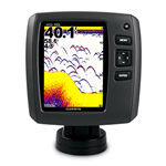
With 500 W (RMS) power, depths to 1,900 ft in fresh water and a 5" color display, echo 500c ushers in the next generation of fishfinders.
Experience Picture-perfect Fishing
Echo 500c scans the waters with 500 W (RMS) power and extra-sensitive HD-ID™ target tracking technology, and boasts a 5" (12.7 cm) QVGA display. A dual-beam transducer optimizes performance for deep or shallow water, offering wide-angle (up to 120 degree) coverage to target fish beyond the sides of your boat and the ability to scan bottom profiles down to 1,900 ft (579.12 m) in fresh water.
For an uninterrupted view of the sonar image, echo 500c has Smooth Scaling™ technology, which means you won’t lose sight of the sonar history as the unit changes depth ranges. It also features the ability to rewind your sonar history in order to ensure that you haven't missed a thing.
For more information and additional models
click here for the Garmin site.
For Blue Chart info click here.
For Fishing Hot Spot Info from Garmin click here. |

Buy Now at our Online Store |
- Handheld GPS
GPS 72H
Make a splash with the GPS 72H, a lightweight, waterproof handheld that floats. Simple yet robust, the GPS 72H features high-sensitivity GPS and a USB connection along with its large screen, simple operation and rock-solid performance.
GPS MAP78
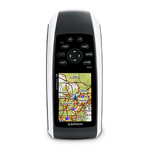
For boaters and watersports enthusiasts who want to run with the best, the rugged GPSMAP 78 features crisp color mapping, high-sensitivity receiver, new molded rubber side grips, plus a microSD™ card slot for loading additional maps. And it floats!
Explore
GPSMAP 78 comes with built-in worldwide basemap, so you can navigate anywhere with ease. And, like the rest of the 78-series, the 78 is IPX7 waterproof and even floats in water.
Keep Your Fix
With its high-sensitivity, WAAS-enabled GPS receiver and HotFix™ satellite prediction, GPSMAP 78 locates your position quickly and precisely and maintains its GPS location even in heavy cover and deep canyons. The advantage is clear — whether you’re in deep woods or just near tall buildings and trees, you can count on GPSMAP 78 to help you find your way when you need it the most.
For more information and additional models
click here for the Garmin site. |

Buy Now at our Online Store |
- Two-Way Communications
VHF 100
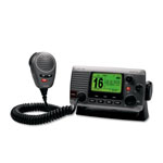
The Garmin VHF 100 marine receiver features intuitive design and provides radio communication to enhance convenience and safety to mariners worldwide.
Communicate with Confidence
With up to 25 watts of transmit power at your fingertips, you’ll be able to stay in touch anywhere on the water. So no matter where you are or where you’re heading, you’ll always have a line of communication open to make sure every voyage is a safer voyage.
Safety First
The Garmin VHF 100 provides full Class D Digital Selective Calling (DSC) capability via NMEA 0183 interface. Should trouble arise, DSC provides distress calls with the push of a button. And if your boat is already interfaced with a compatible GPS chartplotter, you’ll get mayday signaling and a digital broadcast of your boat’s position. The VHF 100 also features NOAA weather alerts and Position Tracking, which allows a mariner to locate and keep tabs on up to three other boats in the area.
At-A-Glance Information
The VHF 100 has a simple user interface that’s easy to read while on the go, so you’ll always have the right information at the right time. In addition to dedicated buttons and knobs for ease of use, the VHF 100 features three soft keys linked to onscreen menus that allow boaters to see and select the information they want. The VHF 100 also offers premium sound quality so every message is loud and clear. And to make sure the data stands out, the information is available on a 3.2" (8.13 cm) display – the largest screen available in its class.
For more information and additional models
click here for the Garmin site. |
Buy Now at our Online Store |
Radar
The GMR 18 brings you the power of X-band digital marine radar scanning like never before.
Get Powerful Performance
GMR 18 is a 4 kW radar with 36 nm range. At 0.45 m in diameter, it is twice as powerful as most other radars in its size and price range. Combine that with the antenna's 5 degree beamwidth, and you're looking at the best weather penetration and target definition in its class.
To help you avoid traffic on the water, the GMR 18 provides MARPA target tracking, which allows you to track the bearing, course, speed and predicted closest approach of up to 10 targets. And like all Garmin radars, GMR 18 has self-contained signal processing, which provides you with a more precise, easy to read signature.
Connect to the Garmin Marine Network
The GMR 18 transmits data over the Garmin Marine Network, a 100 MB plug-and-play proprietary network that gives you the ability to expand your boat's system as needed. Once connected to the network, you can use any network-compatible Garmin chartplotter as your radar screen. And as an aid to locational awareness, you can overlay the GMR 18 radar image on the chartplotter's map page. You also can split the on-screen display so that you can view the map and the standard radar page simultaneously.
For more information and additional models
click here for the Garmin site. |

Buy Now at our Online Store |
| Garmin Accessoreis |
|
|