Marine Electronics
Electronic Charts and Maps
 |
 |
 |
 |
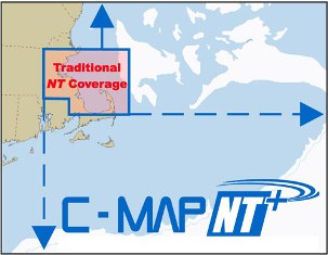
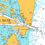
| The best electronic charts just got better! The release of C-MAP NT+ marks another milestone in the evolution of the award-winning NT product that has been at the core of the best electronic charting systems for the past five years. NT+ is the "next generation" of C-MAP electronic charts, featuring much wider coverage areas at substantially lower prices. NT+ electronic charts are derived from official paper charts, and offer:
- Global electronic chart coverage
- Rich detail and information
- Port & Tide™ Info
- Continuous and seamless chart data
- Easy on-screen query of all chart objects displayed
- Detailed display of NavAids
- North-up and course-up orientation
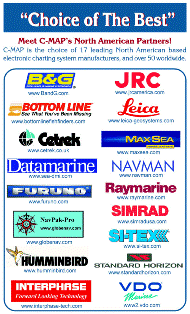
- A large choice of charting systems, as the majority of the world’s leading manufacturers use C-MAP technology!
|
C-Map Website
C-Map Pricing
Chart Lists
PC Planner
|

Navionics Website |
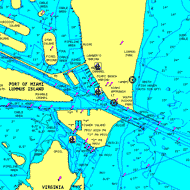
MARINE CHARTS
Electronic Charts For Your GPS Chartplotter
Navionics charts cover the world providing navigators and fisherman with all the necessary data for safer and easier navigation. Provided by geographic area on pre-programmed cartridges compatible with today's most popular chartplotters including: Eagle, Furuno, Geonav, Humminbird, Lowrance, Northstar and Raymarine.
Just plug-and-play into a Navionics compatible plotter and have easy access to all the essential information found on official paper charts and fishing maps: tide and current data, depth contours, spot soundings, navaids, location names, detailed port plans, port service guides, and more.
Navionics Website
Complete Chart Catalog |
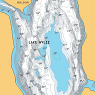
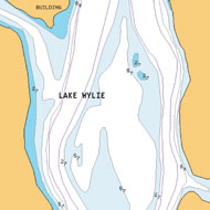
HOTMAPS®
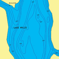
Thousands of US lake maps in 4 huge new regions. Navionics HotMaps take the guesswork out of finding fish! With up to 16 crystal-clear zoom levels and easy-to-read detail anglers are able to determine which spots are most likely to hold fish and the best way to get there. At a glance locate structure, reefs, drop-offs, vegetation, buoys, marinas, boat ramps and more.
Available on pre-programmed plug-and-play cartridges compatible with today's most popular chart plotters including: Eagle, Furuno, Geonav, Humminbird, Lowrance, Northstar, Raymarine and more.
|
NEW! HotMaps Premium -
$149.00
Over 3,000 Lake Maps

Buy Now at Our Online Store |
HotMaps Platinum
$199.00
Over 1,000 Lake Maps
featuring a paper chart appearance
Buy Now at Our Online Store |
 |
| HotMaps Classic - Over 1,000 Lakes
Buy Now at Our Online Store

Navionics Website
|
Marine Electronics
 Back Back
Home
To order Call 1-866-868-7151
or email boatparts@boatsunlimitedny.com |